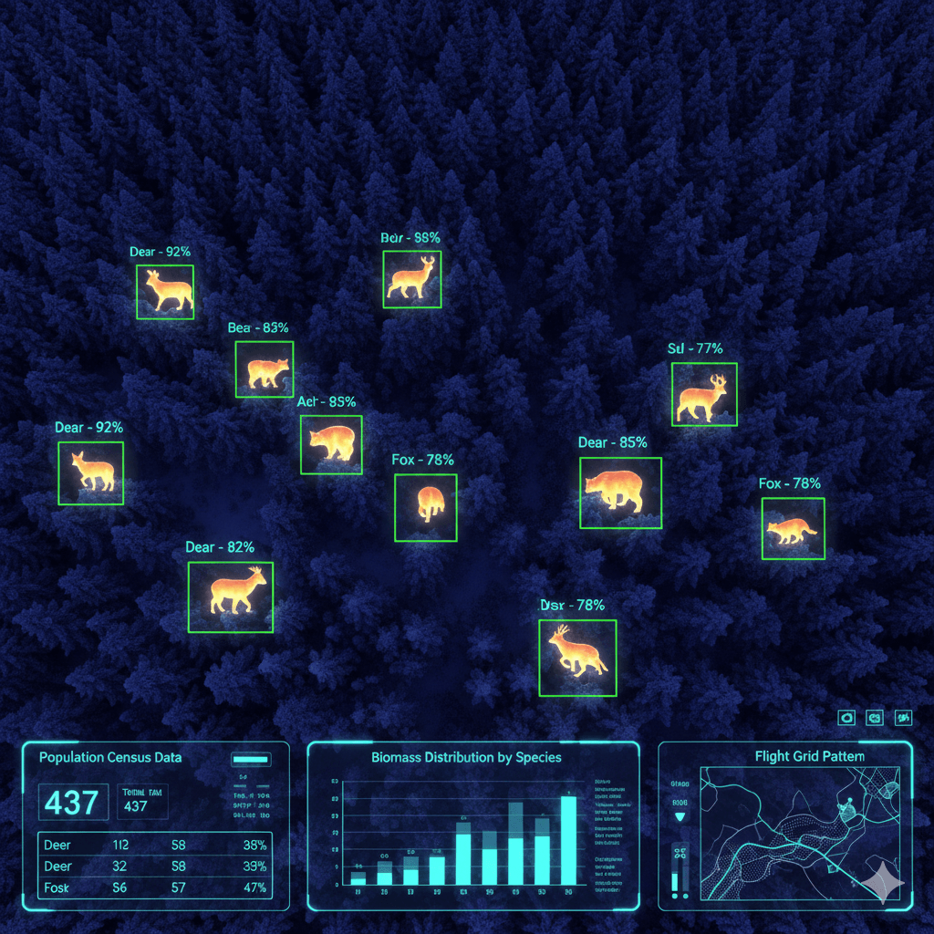
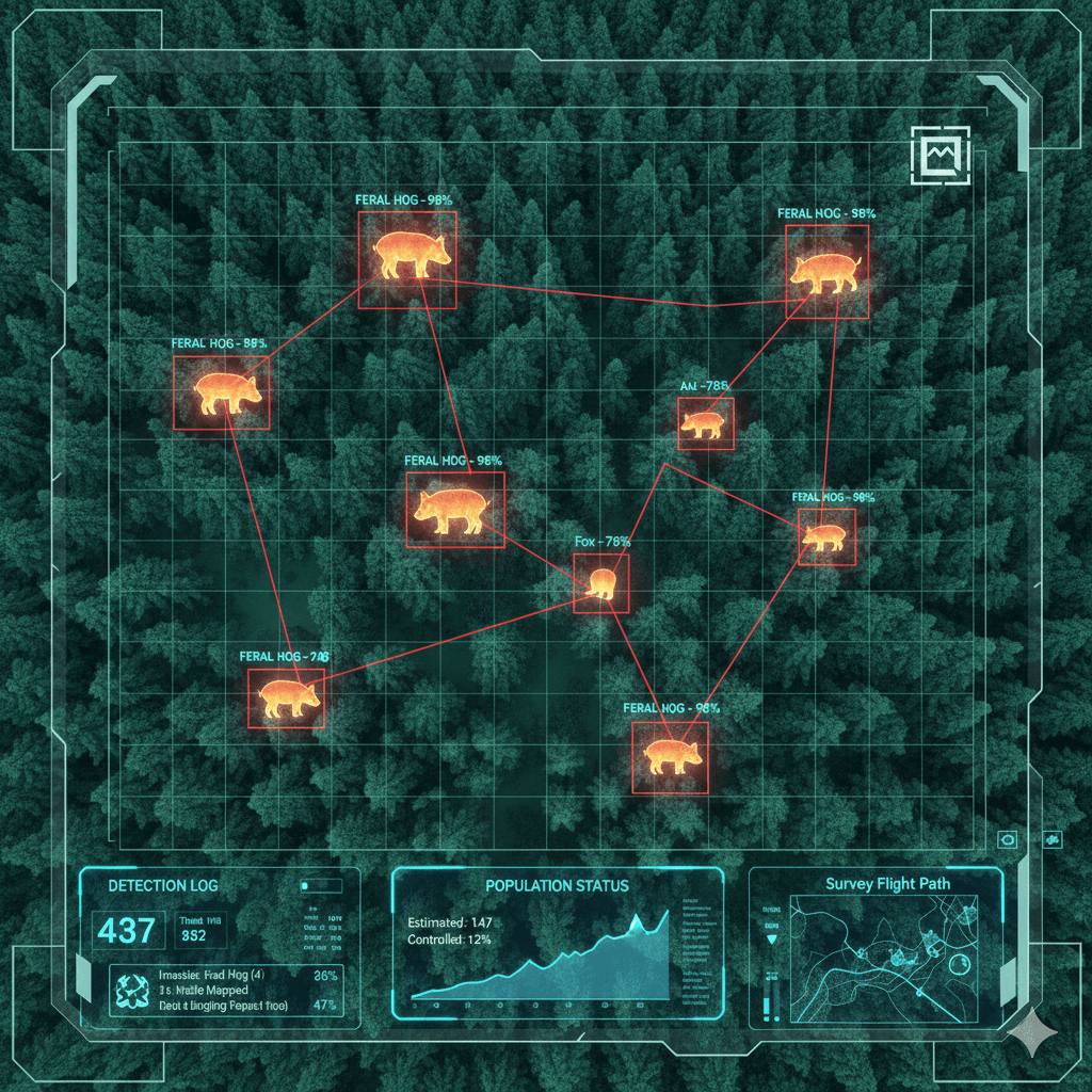
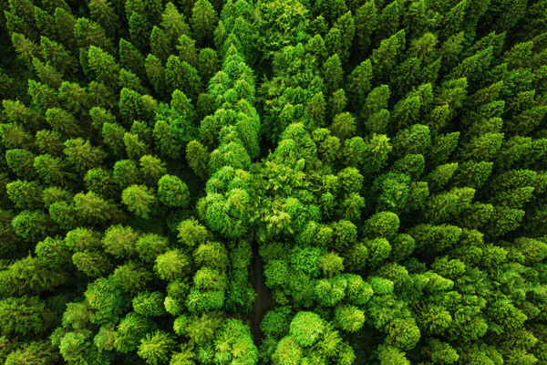
Drone-Based Forest Monitoring. See the Unseen. Protect the Wild.

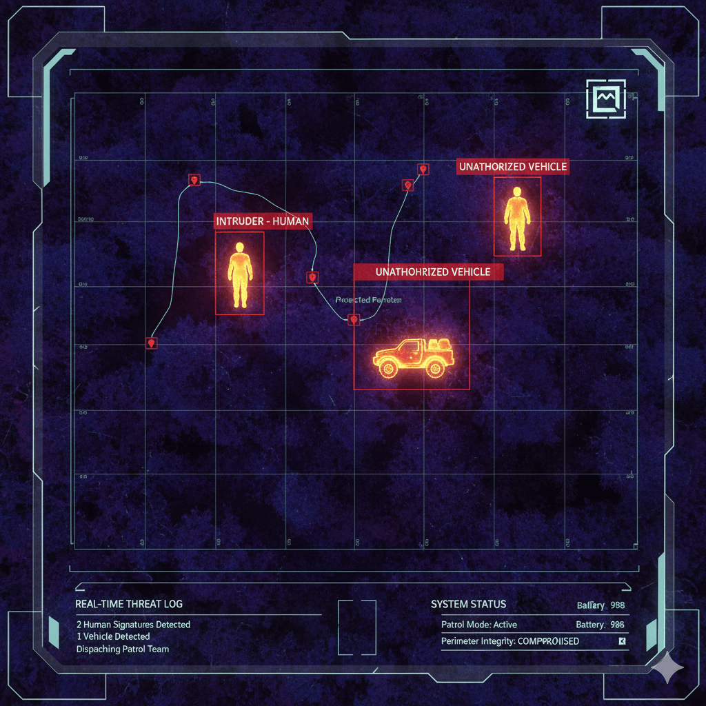
For conservationists, forestry services, and research institutes, we build custom AI models that support drone vision to detect wildlife through dense canopy, prevent poaching, and automate population surveys using Thermal and RGB sensor fusion.

Why Ground Surveys Miss the Big Picture?

Tracking wildlife on foot or by manned helicopter is expensive, dangerous, and disturbs the animals you are trying to study. Relying on traditional methods creates three critical data gaps:

Terrain

The "Canopy" Blind Spot

Visible cameras can't see through leaves. Animals hiding in dense forests go uncounted. Our Thermal Vision AI detects heat signatures through the foliage, revealing hidden populations.

Precision Agriculture

Human Disturbance

Walking the forest scares animals away, skewing your count. Our High-Altitude Drones fly silently above the ecosystem, capturing natural behavior without human interference.

LivestockSmooth-Passenger-Experienc

Poaching Vulnerability

Park rangers can't patrol a million acres at once. Our AI detects Human Activity (poachers/vehicles) in restricted zones at night, alerting rangers instantly.

Solutions for Ecosystem Management

Automated Population Census

Automated Population Census

For biologists, we fly grid patterns over the forest. The AI counts every heat signature, classifying species (e.g., "Deer" vs. "Bear") based on thermal profile size and movement patterns.

mid2

Anti-Poaching & Perimeter Defense

For rangers, we deploy autonomous "drone-in-a-box" systems that patrol boundaries 24/7. The AI flags human heat signatures or vehicles in protected areas and sends GPS coordinates to patrol teams.

Invasive Species Tracking

Invasive Species Tracking

For land managers, we train models to detect invasive animals (e.g., Feral Hogs) that destroy habitats. The system maps their den locations, allowing for targeted population control.

How We Engineer Thermal Intelligence?

Terrain

Step 1: Thermal & RGB Fusio

Thermal sees the "blob," but RGB sees the "color." We fuse both camera feeds. The thermal sensor finds the animal (hot spot), and the RGB sensor confirms the species if visible (visual ID).

Precision Agriculture

Step 2: Canopy Penetration Logic

A thermal signature under a tree looks fragmented. Our temporal tracking algorithms analyze the "flicker" of heat as the animal moves between gaps in the leaves to reconstruct the full shape.

LivestockSmooth-Passenger-Experienc

Step 3: False Positive Reduction

Sun-heated rocks look like animals. We train our models on "negative samples" (hot rocks, water reflections) to teach the AI the difference between a stone and a living, moving creature.

Pipeline Inspection

Step 4: Flight Path Automation

We program the drone to fly "Llwnmower patterns" with 80% overlap. The images are stitched into a massive thermal orthomosaic map for total area analysis.

Customer Story

forest animal

Project's Summary

Counting deer in our 5,000-acre reserve took weeks of night spotting. Folio3 built a thermal drone pipeline that surveyed the entire forest in two nights, identifying 30% more animals than our best ground count." — Director of Conservation, State Forestry Department 95% Detection Accuracy (Thermal) 10x Faster Than Ground Surveys Zero Human Risk

Our Tech Stack

Tech-stack
Folio3.ai leverages the world’s most powerful AI frameworks, models, and acceleration platforms to build secure, scalable, and production-ready AI solutions. Our expertise spans generative AI, deep learning, MLOps, and high-performance inference.

Frequently asked questions

It depends on the resolution. From high altitude, we categorize by size ("large mammal"). Lower altitude flights allow for species-specific ID based on gait and silhouette.
Thermal works best at night or early morning when the ground is cool, and the animal is warm (high contrast). Mid-day sun heats the ground, creating "thermal clutter" that reduces accuracy.
For large areas, we recommend autonomous "Beyond Visual Line of Sight" (BVLOS) operations where legal. Our software handles the flight path, so the pilot is mostly a safety observer.
Yes. We can train models to detect nests in the canopy (RGB) or roosting birds (Thermal), vital for monitoring endangered avian species.

Ready to Automate the Survey?

Stop guessing populations. Start measuring them.

forest animal detection
Contact

Let's get in touch

Fill the form below or Contact us at +1 408 365-4638 / email us via contact@folio3.ai

This site is protected by reCAPTCHA and the Google
  • 22+ Years

    of Experience In the AI Domain

  • 950+ Projects

    Delivered Worldwide

  • 99%

    Client Satisfaction

  • Est. 1995

    Founded

  • Same Day

    Response Guaranteed

Support

Contact Info

+1 408 365-4638
contact@folio3.ai

Map

Visit our office

6701 Koll Center Parkway, #250 Pleasanton, CA 94566