Artificial Intelligence

From bridges and railways to power lines and pipelines, drone infrastructure inspection covers everything that requires constant monitoring to ensure public safety and operational reliability.
Ensuring these structures remain safe and operational requires frequent, detailed inspections.
While effective, traditional methods are increasingly challenged by high costs, access limitations, and safety concerns.
That’s where drone infrastructure inspection is transforming the industry.
Studies show drones can reduce inspection costs by up to 75% while increasing efficiency by 33% compared to traditional methods, revolutionizing how we maintain critical infrastructure.

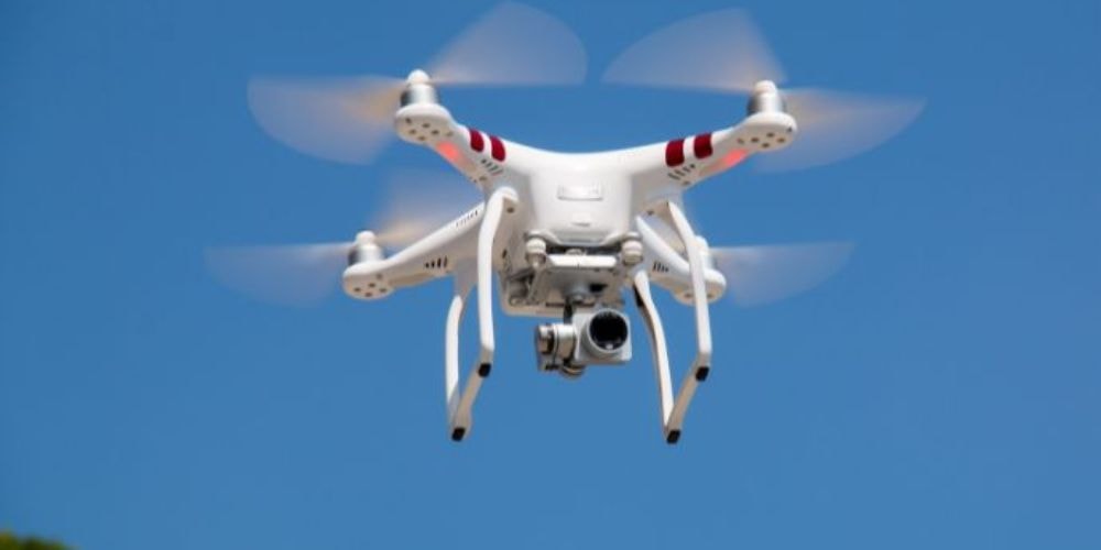
Drone infrastructure inspection is the use of unmanned aerial vehicles (UAVs) to collect visual, thermal, and multispectral data from critical infrastructure assets. This data is then analyzed—often with the help of AI—to assess the condition of assets and identify potential risks.
While traditional inspections have worked for years, they come with a lot of headaches. Let’s break down how drones are making life easier.
Old-school inspections usually involve scaffolding, trucks, rope access, or even helicopters. These approaches often mean:
Traditional inspections often rely on heavy machinery, like bucket trucks, scaffolding, or even helicopters, skilled laborers, and safety gear. Between insurance, equipment rental, and pilot wages, the expenses quickly add up and eat into budgets.
Imagine shutting down a lane on a highway or taking a power line offline just so an inspector can reach it. These interruptions cause traffic backups or service outages and cost both public agencies and private companies valuable time and money.
Inspectors often work in dangerous conditions: at high elevations, over water, or around high-voltage lines. These situations not only stress teams but also increase your liability and insurance premiums.
Narrow spaces, remote structures, or challenging angles are frequently under-inspected due to safety or access limitations. This increases the risk of problems going unnoticed until they become emergencies.
A typical inspection might take days or weeks, including site access, data capture, and post-inspection paperwork. Reports are handwritten or manually assembled, which can delay critical maintenance decisions.
Now, let’s look at what happens when you bring drones into the mix:
Drones can fly under bridges, over towers, or into confined industrial spaces with no need for scaffolding or machinery, so you get a full view without safety concerns.
As drones collect images and sensor readings, teams on the ground can view the data live, spotting rust or heat anomalies that tend to get flagged immediately, allowing faster responses.
A single pilot with a high-end UAV and sensor package can cover what used to take teams of inspectors. That reduces crew costs, travel, and equipment needs, delivering savings quickly.
Most inspections can be completed while systems stay active—power lines can stay live, roads open, and facilities running. You only stop parts of assets if there’s a clear need.
With drones, inspections that once took days can be done within hours. Additionally, you gain enhanced visuals, sensor-rich data, and software that identifies issues, streamlining the decision-making process.

Different drone types offer unique advantages depending on the inspection task. Choosing the right drone ensures efficiency, accuracy, and safety during utility assessments.
Fixed-wing dronesIdeal for covering large areas quickly. Long flight times and efficient energy use make them perfect for inspecting pipelines, power lines, and wide terrains.
Multirotor dronesExcellent for detailed inspections in tight or vertical spaces. Capable of hovering and precise maneuvering around poles, towers, and transformers.
Hybrid dronesCombine the endurance of fixed wing with the agility of multirotor. Suitable for mixed environment inspections requiring both range and stability.

Drones carry different tools depending on what you’re inspecting:
Perfect for close-up shots that let engineers see fine details on buildings or support beams.
Helps you build a highly accurate 3D model of your structure, useful for inspecting bridges or tracking changes over time.
Finds hot spots in solar panels, power systems, or water pumps—often before something fails.
These can catch early signs of leaks, mold, or wear and tear that you might miss with the naked eye.
Raw data needs to be processed, and with the help of AI, it can be quickly turned into clear, actionable insights that help you make better decisions faster.
Gathering data is just the first step. Here’s how we turn it into answers:
AI does the heavy lifting Smart software automatically flags things like cracks, overheating parts, or loose connections—way faster than doing it by hand.
3D models for better understanding You get a virtual version of the asset, making it easier to review and plan repairs or upgrades.
Easy-to-read reports The system generates clear reports that show what’s wrong, where it is, and what needs to happen next.

Drones aren’t just for one industry. Here’s where they’re making a big difference:
Drones inspect roads, railways, and bridges with minimal traffic disruption, capturing detailed visuals to detect cracks, corrosion, or surface wear—without large crews or road closures.
Solar farms, wind turbines, and power lines are scanned for wear, heat anomalies, or damage using thermal and visual sensors, enabling faster maintenance with minimal downtime.
Pipelines and offshore rigs are inspected for leaks, corrosion, or structural issues. Drones improve safety by reducing the need for manual checks in hazardous or remote environments.
Dams, reservoirs, and treatment plants are surveyed for cracks, leaks, or erosion. Drones access hard-to-reach areas and collect thermal data to ensure system integrity.
Cell towers and antennas are inspected for structural damage, cable faults, or environmental risks like tree overgrowth—no need for climbing or shutdowns during drone assessments.
Agriculture
Drones monitor crop health, soil conditions, and irrigation efficiency using multispectral sensors. They help farmers detect issues early, optimize yield, and reduce the need for manual field surveys.
Construction
Construction teams use drones to track progress, inspect structures, and ensure site safety. Aerial data improves planning, documentation, and issue detection without interrupting daily operations.
While drones bring a lot of benefits, there are still a few things to keep in mind:
Heavy rain, high winds, or fog can delay or degrade inspections. Planning around the weather is essential.
Most drones fly between 20–30 minutes per battery. For long missions, you’ll need extras or swap-out teams.
High-res photos, thermal maps, and LiDAR all generate large files, requiring reliable cloud or local storage capacity and secure protocols.
FAA-certified drone pilots and data analysts are a must for safety, compliance, and interpreting complex results.
Push notifications, issue tracking, and software integration with legacy systems (like EAM or GIS) may need custom development or middleware solutions.
A renewable energy company needed reliable inspections across solar farms in multiple countries. Manual methods were slow, data processing took too long, and inspection quality varied.
Our approach
We developed a custom AI model to analyze drone footage, automatically detecting panel defects, hotspots, and dirt. The model is integrated into the client's portal, sorting frames and labelling issues by type and priority.
Impact
Achieved over 90% detection accuracy
Cut inspection turnaround from days to hours
Empowered proactive maintenance, boosting energy output
Read more: Drone solar panel inspection solution - case study
At Folio3, we build AI-powered drone inspection solutions that help you get more from the drone data you already collect.
Whether you're inspecting power lines, bridges, solar farms, or pipelines, our job is to turn your aerial data into something useful, fast.
Custom AI models
We design inspection algorithms that match your specific assets, detecting cracks, corrosion, heat anomalies, or vegetation overgrowth based on your operational needs.
Real-time insights
Our software delivers instant results on a clean dashboard, so you can act quickly, whether it's a fault alert or a maintenance recommendation.
Seamless Integrations
No need to change your equipment. Our solution works with your existing drones, inspection workflows, and asset management systems.
Secure data storage
Choose from cloud-based or on-premise storage. Either way, your data stays safe and accessible only to your team.
Predictive analytics
Go beyond reactive fixes. Our tools use AI to spot patterns and trends, helping you catch small issues before they turn into big problems.

It’s when drones are used to take pictures and scan structures like bridges or towers to check for issues like cracks, rust, or overheating.
Yes! You save on equipment, labor, and downtime—and you get faster, more accurate results.
Yes. You can schedule regular flights to track changes over time and fix problems early.
Commercial drones must follow FAA Part 107 rules, including having a certified pilot and flying within allowed limits.
No, we provide smart software that works with any drone to help you analyze inspection data and make better decisions.