Artificial Intelligence

In 2025, drone technology continues to advance, particularly with the integration of computer vision, enabling real-time object detection, anomaly recognition, and autonomous navigation. For example, AI-driven inspection drones in the energy sector can detect micro-cracks in solar panels with high precision, preventing failures and optimizing maintenance.
Computer vision is at the core of this capability, allowing drones to process and interpret visual data using deep learning, edge computing, and sensor fusion. These functionalities power terrain mapping, defect detection, facial recognition, and environmental monitoring, making drones indispensable across industries. In agriculture, drones analyze crop health, while in construction, they track site progress and detect safety hazards.
Security, logistics, and disaster response also benefit from this technology, making 2025 a pivotal year for drone computer vision as adoption accelerates and AI models become more sophisticated. Keep reading for more insight into advancements and Applications in drone computer vision.
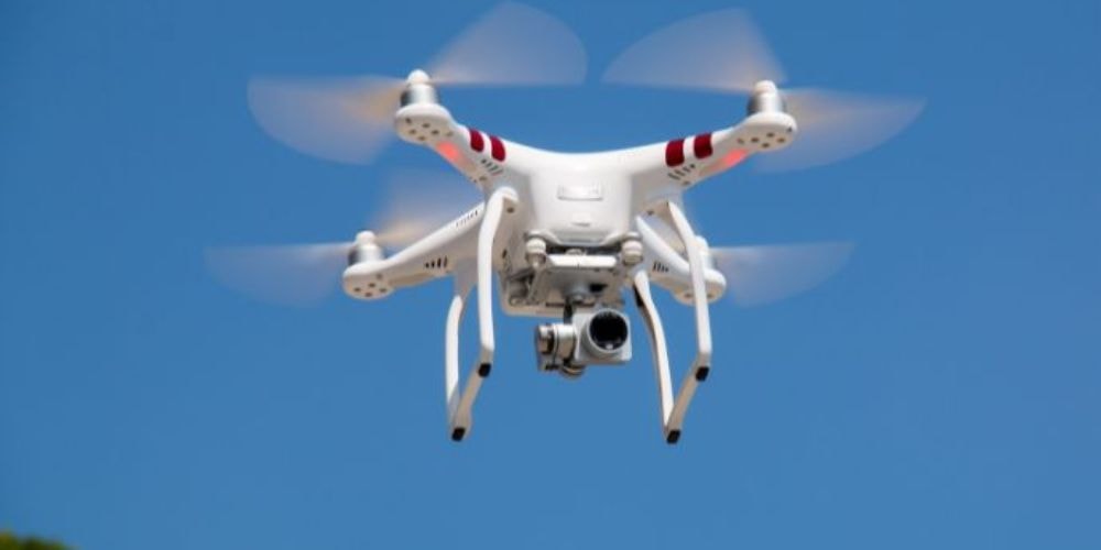
Computer vision in drones helps them to interpret and perceive visual data, navigate autonomously, detect objects, and analyze environments. It integrates AI, deep learning, and neural networks to process images and videos from a camera in real time.
Drones process the captured data to identify and classify objects, track movement, and make decisions based on visual input.
AI enables drones to analyze and understand images and videos captured by onboard cameras. Through machine learning models, drones can detect patterns, recognize objects, and make real-time decisions without human intervention. Drone inspection software enhances this capability by providing advanced analytics, automated defect detection, and streamlined data processing for various industries.
Deep learning, particularly Convolutional Neural Networks (CNNs), helps drones detect and classify objects such as vehicles, humans, buildings, and obstacles. CNNs process image pixels layer by layer, identifying shapes, textures, and patterns to improve recognition accuracy.
Neural networks help drones navigate complex environments by analyzing visual data and predicting the safest route. Using reinforcement learning, drones continuously improve their flight paths, avoiding obstacles like trees, power lines, and buildings.
Drones process high-resolution images and videos using onboard GPUs and edge AI, ensuring real-time analysis. This is essential for applications like live surveillance, inspection, and search-and-rescue operations, where immediate decision-making is required.
Computer vision algorithms extract key features such as edges, contours, and motion from images. This helps drones understand depth, distance, and object movement, enabling accurate tracking and monitoring.
Drones, including LiDAR, infrared cameras, and GPS, integrate multiple sensors to improve spatial awareness. Sensor fusion combines data from these sources, allowing drones to operate effectively in different lighting and weather conditions.
Computer vision in drones identifies anomalies by analyzing visual data for irregularities. This technology is particularly useful for detecting structural damage in buildings, monitoring crop health in agriculture, and identifying security threats in surveillance applications.
Many types of drones incorporate computer vision technologies, each with unique applications and capabilities, from surveillance to mapping and agriculture. Below are different types of computer vision technologies integrated into drones, along with their functions.

These drones use AI-powered vision systems to detect and classify objects in real-time. They are widely used in security surveillance, military reconnaissance, and search-and-rescue operations to identify vehicles, people, or obstacles.
Drones with machine learning algorithms can categorize images based on predefined datasets. They play a key role in agriculture (crop monitoring), disaster assessment, and environmental studies, helping analyze landscapes and detect anomalies.
Equipped with advanced AI models, these drones can identify individuals and vehicles based on facial features and license plates. They are mainly used for surveillance and tracking in law enforcement, border security, and traffic monitoring.
These drones track movement by analyzing pixel changes between video frames, enabling them to navigate dynamic environments. They are crucial for autonomous navigation, sports broadcasting, and wildlife monitoring, where tracking moving objects is essential.
Drones with SLAM technology create high-resolution 3D maps while navigating independently. They are widely used in construction site mapping, geological surveys, and infrastructure inspections, offering precise spatial data.
Drones equipped with thermal and infrared cameras detect heat signatures, making them valuable for search-and-rescue missions, firefighting, and industrial inspections to locate people, animals, or overheating machinery.
These drones capture data in multiple spectral bands beyond visible light, helping in precision agriculture, pollution detection, and mineral exploration. They analyze crop health, water quality, and soil composition with high accuracy.
Unlike traditional drones that rely on cloud computing, edge AI drones process data on the device itself, reducing latency. These are used in real-time military surveillance, disaster response, and autonomous drone fleets, where immediate decision-making is crucial.
Drones equipped with computer vision are the primary resource for surveillance and security. They can monitor large areas, detect anomalies, and track objects in real time, making them invaluable for law enforcement and private security firms. Advanced algorithms enable these drones to identify specific individuals or vehicles, enhancing their utility in monitoring sensitive areas.
These drones use high-resolution cameras and deep-learning algorithms to detect unusual behavior.
They can identify specific individuals, track vehicles, and even analyze crowd movements to prevent incidents before they escalate.
Infrared and night-vision capabilities enable 24/7 surveillance, even in low-light conditions.
Dubai Police uses AI-powered surveillance drones to monitor public spaces, track traffic violations, and detect unauthorized activities. These drones have significantly improved law enforcement response times and helped prevent crime.
The agricultural industry really needed a more sophisticated computer-vision drone. Drones help monitor crop health, detect pests, and analyze soil conditions. Multispectral and hyperspectral imaging allow drones to capture detailed data on crop growth and health, enabling farmers to take a thoughtful approach to irrigation, fertilization, and pest control.
Drones equipped with multispectral and hyperspectral cameras analyze plant health by capturing data beyond what the human eye can see.
AI models process this data to detect signs of disease, pest infestations, and nutrient deficiencies, allowing farmers to take corrective actions before major crop losses occur.
Thermal imaging helps identify areas where irrigation is needed, optimizing water usage.
John Deere uses AI-powered agricultural drones to assess soil quality, monitor crop health, and predict yield outcomes. These drones have helped farmers increase productivity by reducing pesticide waste and improving irrigation strategies.
Drones' computer vision plays a critical role in disaster management. They quickly scan affected areas to locate survivors, assess damage, and identify hazards. This capability allows rescue teams to respond more effectively and save lives.
Thermal imaging allows drones to locate survivors trapped under debris or in hard-to-reach locations.
AI-powered object detection helps identify collapsed structures, fires, or hazardous zones.
Drones can deliver medical supplies to areas inaccessible to rescue teams.
During the 2023 Turkey-Syria earthquake, rescue teams used AI-powered drones with thermal sensors to locate survivors beneath collapsed buildings. These drones significantly reduced search times and helped save lives by providing real-time data to emergency responders.
Drones equipped with computer vision can inspect construction sites and infrastructure such as bridges and pipelines. They create detailed 3D models, detect structural issues, and monitor progress, reducing the need for manual inspections and enhancing safety.
3D mapping and SLAM (Simultaneous Localization and Mapping) enable drones to create detailed structural models for analysis.
AI-powered vision systems detect cracks, corrosion, and structural weaknesses, reducing the need for manual inspections.
This improves safety by minimizing the risks associated with human inspections of tall buildings, bridges, and pipelines.
Skydio’s autonomous drones are used for inspecting bridges and high-rise buildings in the U.S. These drones have reduced inspection time by 70% while improving accuracy and worker safety.
Computer vision enables drones to navigate autonomously by detecting obstacles and adjusting their flight paths in real time. This is crucial in environments where manual control is impractical or unsafe, such as industrial inspections or military operations.
Optical flow and LiDAR sensors allow drones to detect and react to obstacles instantly.
AI-powered depth perception algorithms analyze surroundings, ensuring safe flight even in cluttered environments.
This is especially useful for military missions, industrial inspections, and package delivery services.
Amazon’s Prime Air drones use computer vision to navigate urban landscapes and avoid obstacles while delivering packages. Their AI-driven systems adjust flight paths dynamically to ensure safe and efficient deliveries.
Drones with computer vision are used to monitor wildlife populations, track migration patterns, and detect environmental changes. This helps conservation efforts by providing accurate data on ecosystems and wildlife health.
AI-powered object recognition enables drones to identify and count animals, tracking their migration patterns.
Thermal cameras detect nocturnal animals and poachers in protected areas.
Multispectral imaging helps assess vegetation health, deforestation levels, and habitat changes.
The World Wildlife Fund (WWF) uses drones in Africa to track rhino and elephant populations, helping combat poaching. These drones have improved conservation efforts by providing real-time data without requiring human interference.
In military contexts, computer vision-powered drones are used for reconnaissance, creating detailed 3D terrain maps, and identifying potential threats. They enhance mission success rates by providing real-time intelligence and navigating challenging environments autonomously.
Facial and object recognition allows military drones to identify enemy personnel and vehicles.
Autonomous navigation ensures drones can carry out missions without human intervention
AI-powered mapping helps create real-time battlefield assessments for strategic planning.
The U.S. Army uses the RQ-11 Raven drone for surveillance and reconnaissance missions. These drones provide real-time intelligence, enhancing situational awareness and mission success rates.
Alright, so here’s how drones actually "see" and process their surroundings using advanced AI-driven technologies:
This is what makes drones intelligent. They don’t just capture raw visual data; they leverage convolutional neural networks (CNNs) and transformer-based architectures to analyze and interpret images. AI-powered object detection algorithms like YOLO (You Only Look Once) and SSD (Single Shot Multibox Detector) help drones recognize objects, track movement, and make autonomous decisions.
With reinforcement learning, drones continuously refine their navigation and obstacle avoidance strategies based on real-world interactions.
LiDAR (Light Detection and Ranging) technology enables drones to emit laser pulses to construct highly accurate point cloud data for real-time simultaneous localization and mapping (SLAM).
This improves their ability to autonomously navigate complex environments, perform high-precision terrain mapping, and support geospatial intelligence (GEOINT) applications.
Instead of relying on cloud-based computation, drones utilize embedded GPUs, TPUs, and FPGAs for onboard real-time inferencing. This significantly reduces latency in mission-critical tasks like adaptive flight control, real-time video analytics, and collision avoidance using optical flow algorithms.
Drones maintain autonomy even in network-constrained environments by processing data at the edge.
These technologies enable drones to capture data across various spectral bands, providing insights into environmental conditions, crop health, and other factors. Multispectral imaging typically involves a few spectral bands, while hyperspectral imaging captures hundreds of bands, offering more detailed data analysis. This capability is particularly useful in agriculture and environmental monitoring.
What is computer vision for drones?Yes! Drones use computer vision to detect objects, track movement, navigate autonomously, and analyze environments in real-time.
Is Photogrammetry a Computer Vision?
Kind of. Photogrammetry captures and measures images to create 3D models, while computer vision helps drones process and analyze those images for automation and decision-making.
How is computer vision used in drone technology?It enables drones to detect objects, track movements, monitor environments, and make autonomous decisions in real time.
Which industries use drone computer vision?Industries like agriculture, energy, defense, surveillance, logistics, and construction use drone computer vision for inspection and monitoring.
Why choose Folio3 for drone computer vision solutions?Folio3 offers custom AI models, edge deployment, and domain-specific training data to ensure accuracy and scalability for drone-based applications.
The integration of computer vision technology in drones has significantly impacted the capabilities of these aerial vehicles, transforming them into intelligent tools capable of performing complex tasks autonomously.
By leveraging advanced algorithms and real-time data processing, drones can navigate autonomously, detect objects, and analyze environments with unprecedented precision. Industries should adopt this technology to ease operations, reduce costs, and improve decision-making.
As technology continues to evolve, the potential applications of drone computer vision will only expand, making it an indispensable tool for businesses seeking to innovate and thrive in today's fast-paced world.